Mandapeta Fm
Type Locality and Naming
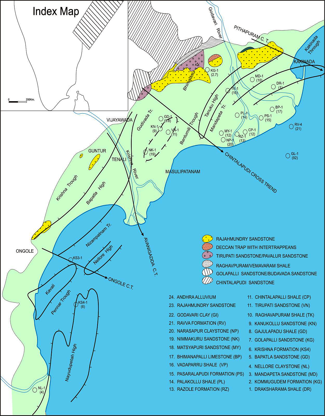
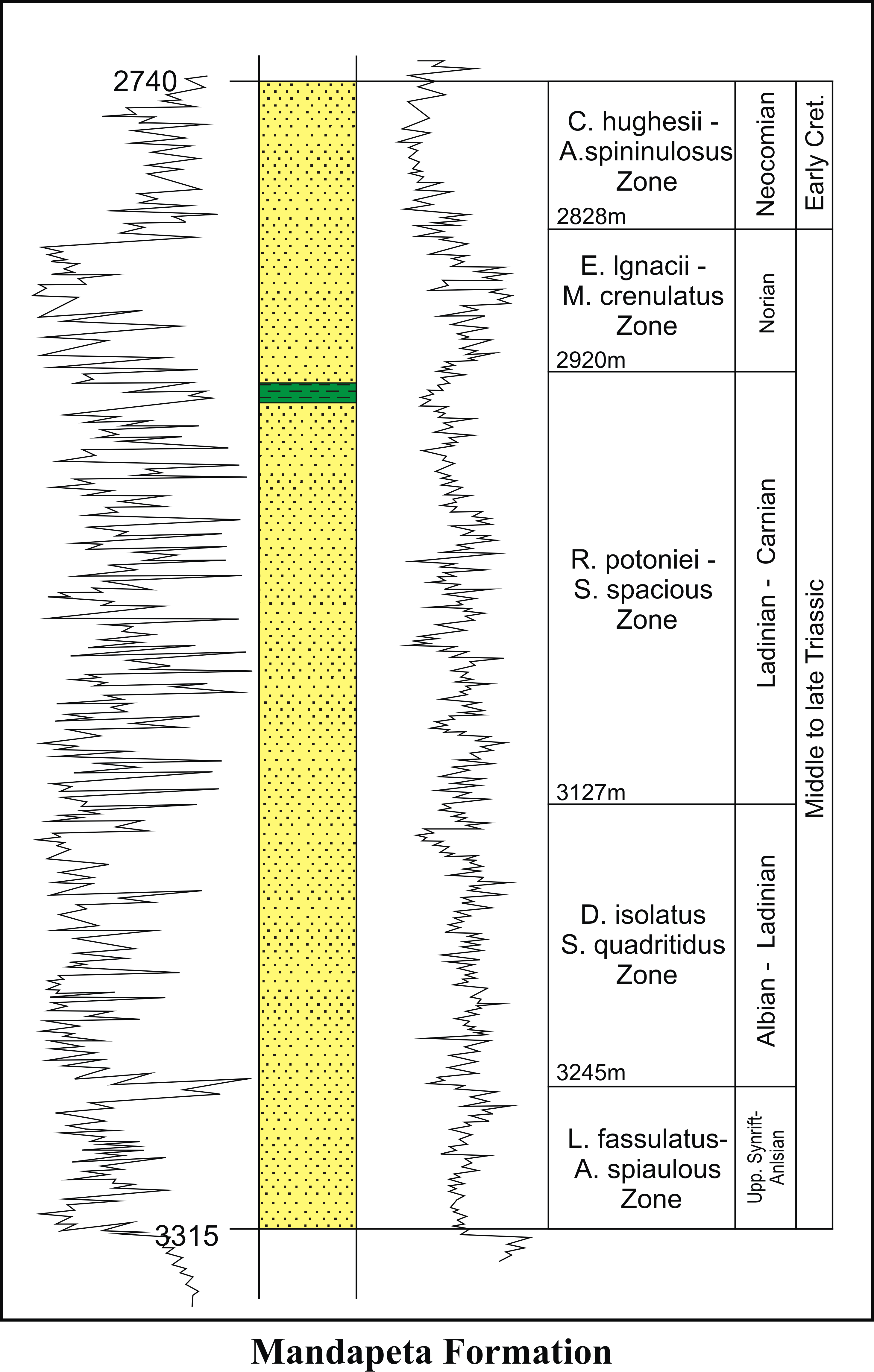
BASINAL: The type section is located at exploratory well Mandapeta-A (depth interval: 3315-2740m), in the Mandapeta subbasin. The hypostratotype is in the well Kommugudem-A (depth interval: 3575-2235m). It was named after the Mandapeta village by ONGC team steered by Venkatarengan et al. (1993) and issued as Document-VII by KDMIPE, ONGC, Dehradun (1993). [Original Publication: Rao, G.N. (1990) Subsurface stratigraphic nomenclature of Krishna-Godavari Basin, ONGC, unpublished report.]. Reference well: Kommugudem – A, Interval 3575-2235 m and thickness 1340 m.
Synonyms: Mandapeta Sandstone
[Figure: Map showing the locations of designated holostratotype section for the formation in the KG Basin (After ONGC, Pandey and Dave, 1998) in Raju et al., 2021, ONGC Bulletin, Special Issue, Vol. 56, No. 2]
Lithology and Thickness
Clayey sandstone. It is dominantly sandstone with minor shale/ claystone. The sandstones are dirty white to greenish-grey, friable, well sorted, felspathic and micaceous, fine to very fine grained, transparent to translucent grains. The claystone are dirty white to light grey, soft to moderately hard, compact, highly silty, non-calcareous to feebly calcareous and appear as very thin bands. Its thickness varies from 575-1340 m.
[Figure: Lithocolumn with corresponding GR and Resistivity logs of the holostratotype of Mandapeta Formation in the Well Mandapeta -A (source: Venkatrengan et al.,1993 and Bijai Prasad, 1999)]
Relationships and Distribution
Lower contact
Unconformable with the Kommugudem Fm.
Upper contact
Major Hiatus -- Unconformable with the Gollapalli Fm.
Regional extent
Present in Mandapeta and Gudivada subbasins.
GeoJSON
Fossils
F.washitaensis, H. planispira (caved).
Age
Depositional setting
Fluvial (braided channel complex)
Additional Information
The assigned age is provisional due to lack of age diagnostic microfossils. "Mandapeta Sandstone of Permo-Triassic age is the principal reservoir rock for this system. It may be noted that these sandstones are in general tight and need frac jobs for exploitation. However, porous and permeable patches are also present and chasing them seismically is a major exploration challenge." The source rock is the Kommugudem Fm (National Data Repository – Krishna-Godavari Basin – Pre-Trappean Petroleum System)

